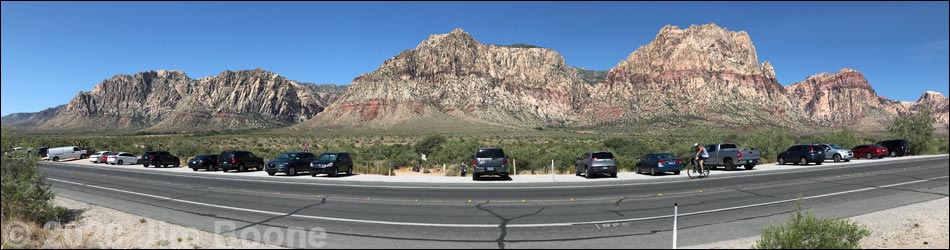
Hiking Around Las Vegas, Red Rock Canyon National Conservation Area
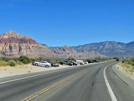
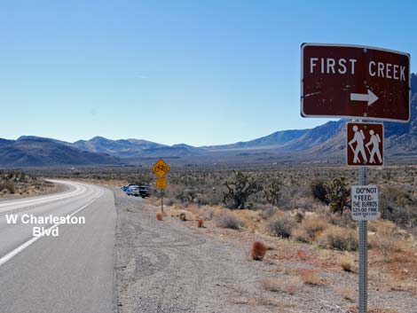 West Charleston Blvd approaching First Creek Trailhead (view S) |
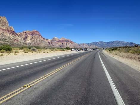
The First Creek Trailhead is hike is located in Red Rock Canyon National Conservation Area, about 25 minutes west of downtown Las Vegas, but not in the Scenic Loop Road fee area. The trailhead is located on West Charleston Blvd (Highway 159) south of the exit from the Scenic Loop Road. This trailhead is not in the fee area. From town, drive out to Red Rocks. From West Charleston Blvd at the entrance to the Scenic Loop Road (Table 1, Site 0519), continue west on Charleston Blvd. for 4.2 miles to a parking area on the right (west) side of the road (Site 0518). This is a broad road shoulder area, not a defined parking lot. Park here; this is the trailhead. Link to trailhead map. |
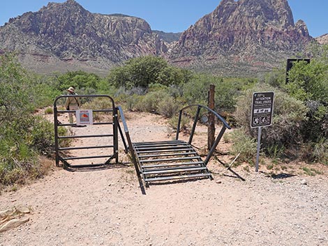 Trailhead gate in the fence (view W) |
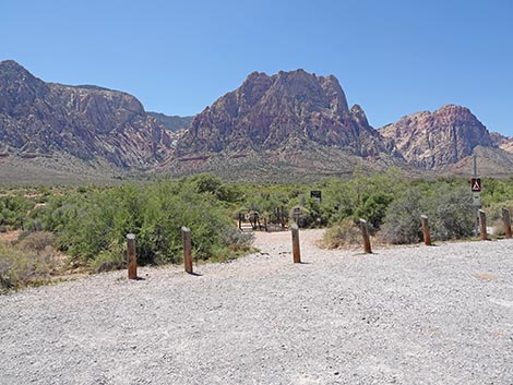
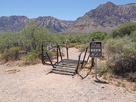
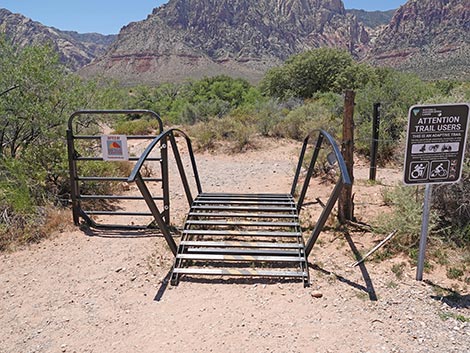
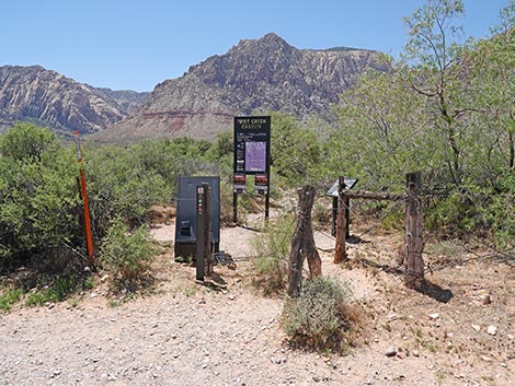
The trailhead is marked by a sign and an information kiosk. If you get to the entrance to Spring Mountain Ranch State Park (Site 0673), turn around and drive back north for 0.5 miles to the trailhead. The main gate has been upgraded to allow access for assistive devices. These are trail-vehicles (e.g., hand-driven trikes and motorized off-road wheelchairs) that allow hikers with walking limitations to access the trails like ambulatory hikers. These gates are not intended to allow access for mountain bikes or ATVs, both of which are illegal here. Even though there is access, this might not be the best trail for riding. The First Creek Trailhead provides access to hikes in the First Creek Canyon area, including access to a seasonal waterfall and several miles of easy to strenuous hiking. Trails: First Creek Falls. First Creek Canyon. |
Approaching First Creek Trailhead from the North
 West Charleston Blvd approaching First Creek Trailhead (view S) |
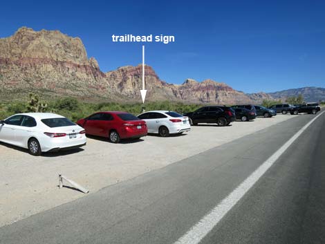
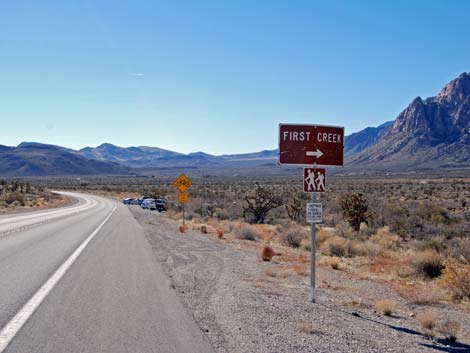 West Charleston Blvd at First Creek Trailhead sign (view S) |
 West Charleston Blvd at First Creek Trailhead (view S) |
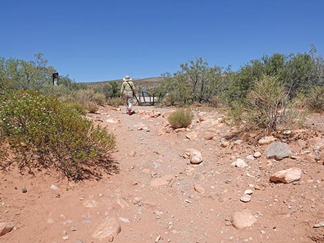
 Walking into the trailhead (view SW) |
Approaching First Creek Trailhead from the South
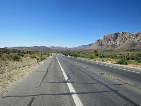
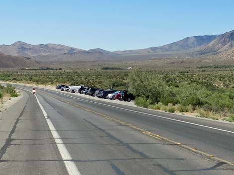
 West Charleston Blvd approaching First Creek Trailhead (view N) |
 West Charleston Blvd at First Creek Trailhead sign (view N) |
 Walking into the trailhead (view SW) |
 Walking into the trailhead (view NW) |
First Creek Trailhead
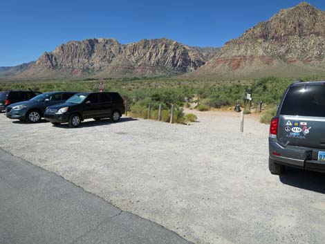
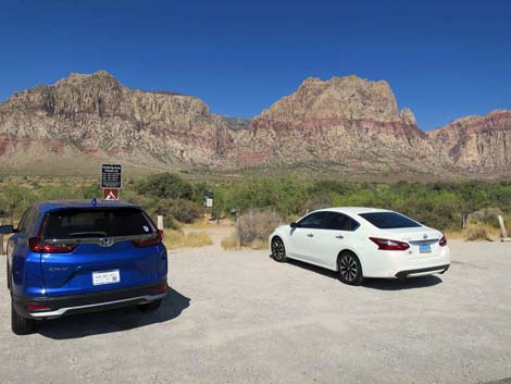
 First Creek Trailhead (view NW from parking area) |
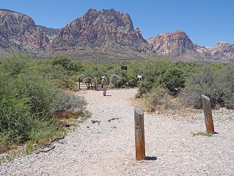 First Creek Trailhead (view NW) |
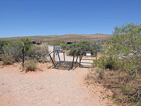
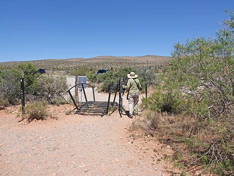
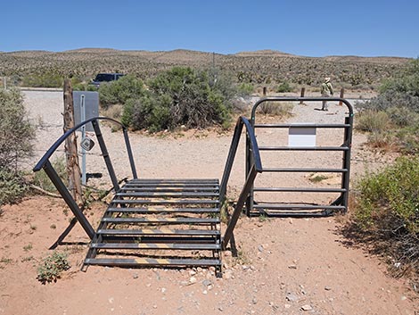
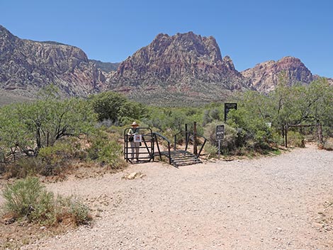 First Creek Trailhead gate (view NW) |
First Creek Trailhead gate (view W) |
 First Creek Trailhead gate and hiker starting on trail (view SW) |
 First Creek Trailhead gate (view W) |
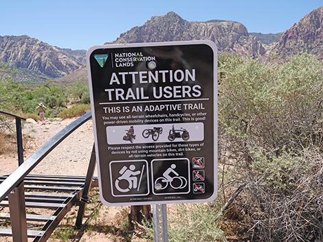 Sign: adaptive vehicles only -- no bikes or ATVs (view W) |
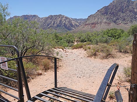 Start of First Creek Trail (view SW from trailhead gate) |
 Original trailhead gate and signs remain intact (view NW) |
 Trailhead: gate in the fence (view NW) |
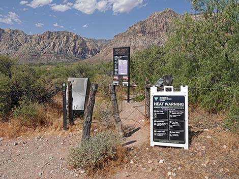
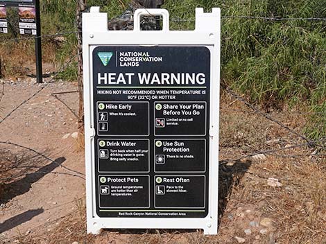 During summer, temporary Heat Warning signs are installed |
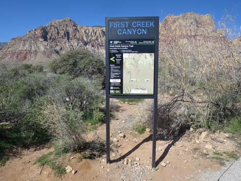 Trailhead sign (view W) |
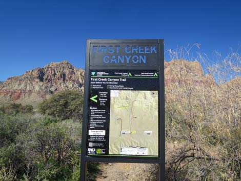 Trailhead sign (view W) |
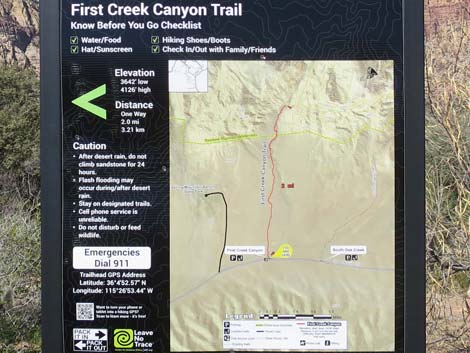 Trail map (view W) |
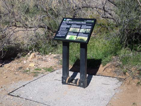 Information sign about invasive weeds with boot brush (view NW) |
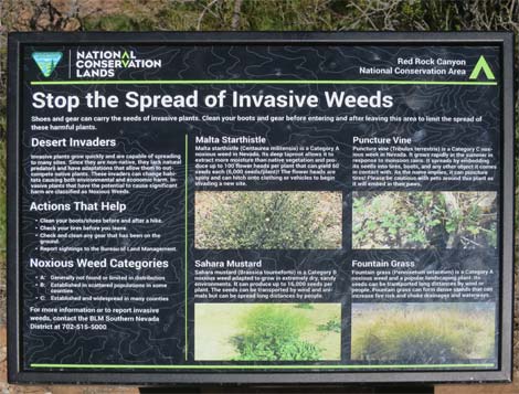 Information sign about invasive weeds (view NW) |
First Creek Trail returning to the trailhead
 Hiker crossing Oak Creek Wash during summer (view NE) Hiker crossing Oak Creek Wash during summer (view NE) |
 Hiker climbing out of Oak Creek Wash during summer (view NE) |
 First Creek Trail returning to the trailhead gates (view NE) |
 Hiker returning through the swinging gate (view NE) |
 First Creek Trailhead gate (view E) |
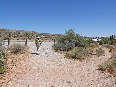 Hiker returning to the First Creek Trailhead parking lot (view SE) |
Table 1. Highway Coordinates (NAD27; UTM Zone 11S). Download Highway GPS Waypoints (*.gpx) file.
| Site # | Location | Latitude (N) | Longitude (W) | UTM Easting | UTM Northing | Elevation (feet) | Verified |
|---|---|---|---|---|---|---|---|
| 0518 | Charleston at First Creek Trailhead | 36.08130 | 115.44720 | 639815 | 3993881 | 3,661 | Yes |
| 0519 | Charleston at Scenic Loop Entrance | 36.13161 | 115.42048 | 642131 | 3999501 | 3,681 | Yes |
| 0673 | Charleston at Spring Mtn Ranch Rd | 36.07365 | 115.44266 | 640237 | 3993039 | 3,600 | Yes |
Happy Hiking! All distances, elevations, and other facts are approximate.
![]() ; Last updated 250524
; Last updated 250524
| Hiking Around Red Rocks | Hiking Around Las Vegas | Glossary | Copyright, Conditions, Disclaimer | Home |