Hiking Around Las Vegas, Mojave National Preserve
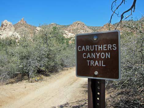 Caruthers Canyon Trail sign, missing after the fire (view N) Caruthers Canyon Trail sign, missing after the fire (view N) |
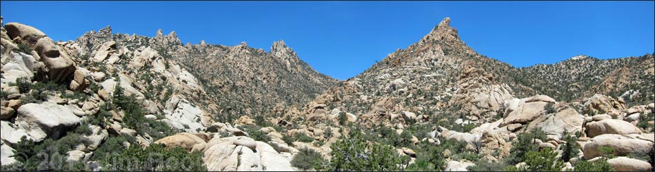
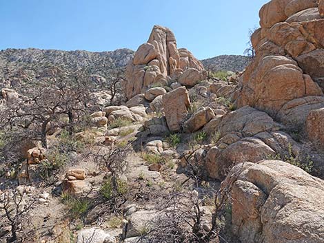
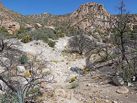
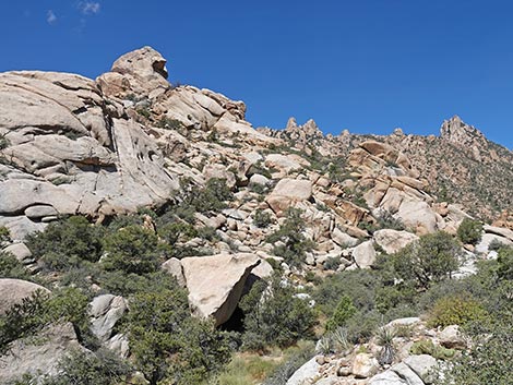
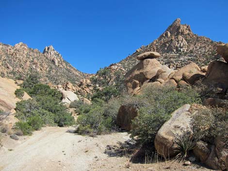
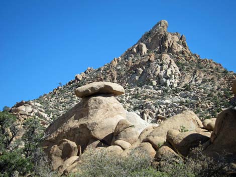
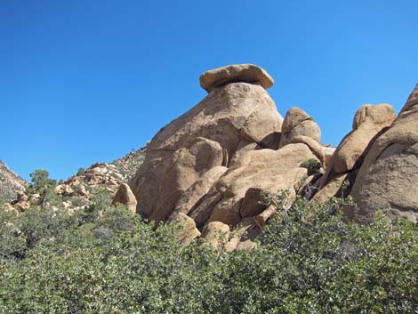
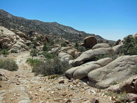
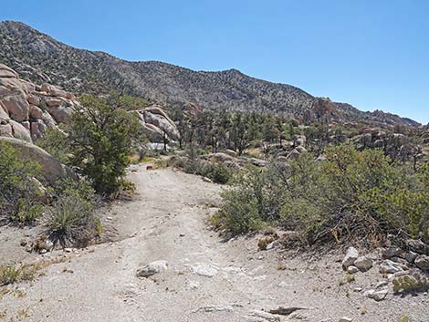
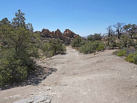
Overview The Giant Ledge Mine Trail runs 1.2 miles up an old road through Caruthers Canyon to the old Giant Ledge Mine. The road parallels Caruthers Canyon Wash, staying on one side or the other, as it climbs at moderate grades through a wonderland of eroded granite rock piles, spires, and balanced rocks. The 2023 York Fire burned the lower canyon, but because the trees are gone from the first half-mile of trail, the views are now more open and expansive. After about 0.5 miles, outside the burn zone, the views are intermixed with relatively lush Pinyon-Juniper Woodland flora that provides shade for hikers. As would be expected for a mine dating from before 1927, it is safer to stay out and stay alive. There is plenty to see while peering into the darkness from the safety of the mine entrances, including one opening that collapsed despite timbers at the entrance. For hikers who want to see inside the mines without the danger, click here. Link to map. |
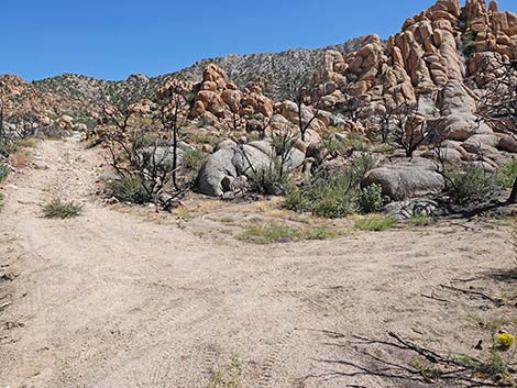
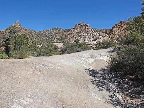
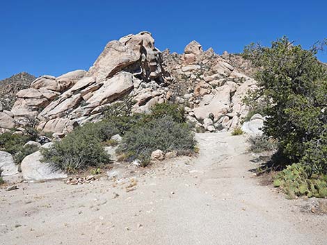
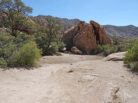
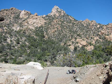
 Trailhead at fork in Caruthers Canyon Road (view N) |
Watch Out Other than the standard warnings about hiking in the desert, ... mines are never safe to enter. I took a calculated risk on this one, and because I did, everyone can look at the pictures and nobody else needs to go inside. Be safe and do not enter the dark, dangerous mines. While out, please respect the land and the other people out there, and try to Leave No Trace of your passage. Due to the remote location of this canyon, be sure to bring the 10 Essentials. |
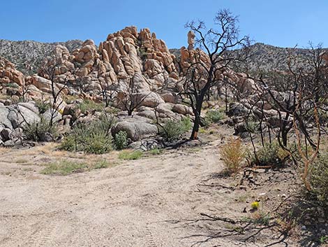
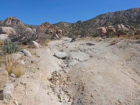
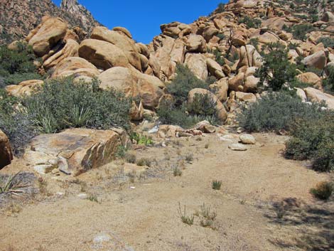
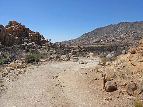
 Caruthers Canyon Rd continues past the campsite turnoff (view N) |
Getting to the Trailhead This hike is located in the Mojave National Preserve, about 2 hours south of Las Vegas. From town, drive south on I-15 into California to Nipton Road. Turn left onto Nipton Road and drive east about 4 miles to Ivanpah Road. Turn right onto Ivanpah Road and drive south for about 24 miles to the signed New York Mountain Road. Turn right onto New York Mountain Road and drive west for about 5-1/2 miles to an unsigned four-way intersection with Caruthers Canyon Road. Turn right onto Caruthers Road and drive north, passing an old windmill, for about three miles to a trailhead at a fork in the road. The best parking is a bit back down the road, but the last parking is just past the fork. Park near here; this is the trailhead. See Caruthers Canyon Road for details. |
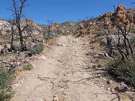
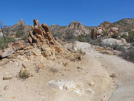
 Caruthers Canyon Rd at a parking area (view N) |
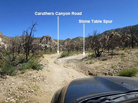
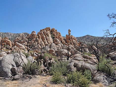
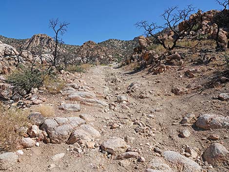
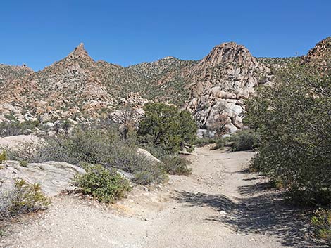
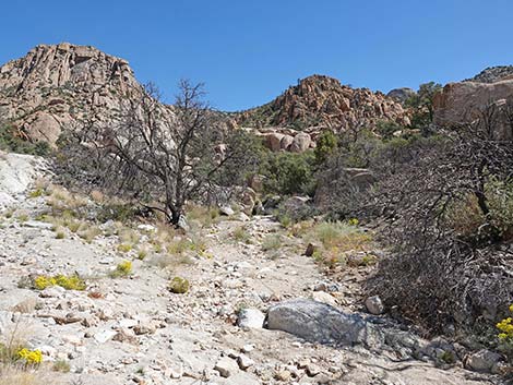
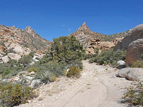
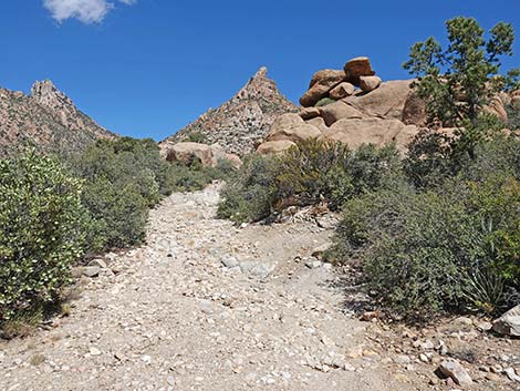
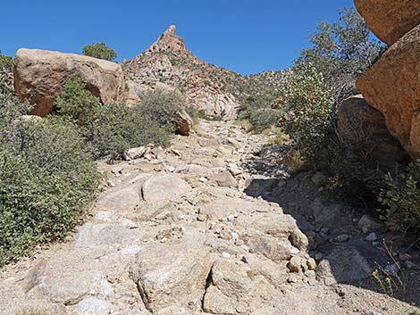
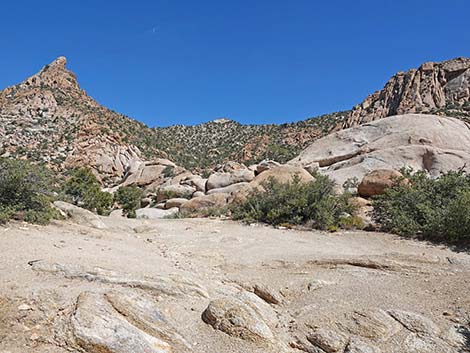
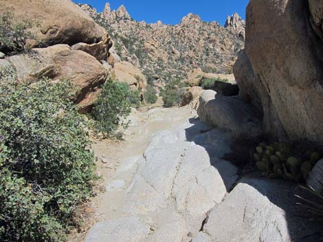
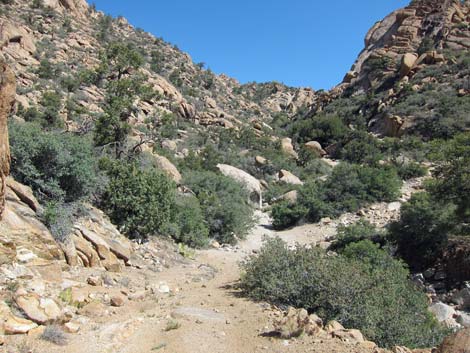
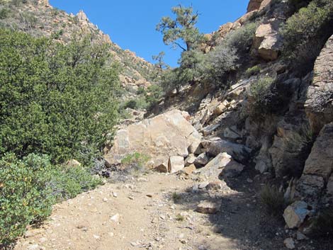
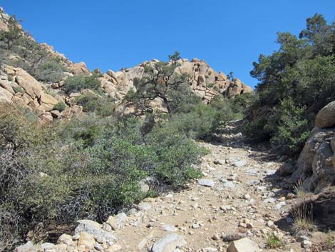
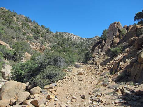
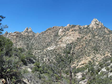
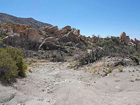
The Hike Regardless of the vehicle driven or the parking spot chosen, continue north on Caruthers Canyon Road. At a fork in the road (Table 1, Waypoint 01) where straight appears to continue up a wash and the right runs up to the stone-table campsite, the route follows the road in the bottom of the canyon. Shortly, the road passes where a sign on the right used to say: Caruthers Canyon Trail (Wpt. 02A). Along this section, the road used to be bordered by heavy Shrub Live Oak and shaded by Single-leaf Pinyon Pine, but the fire changed all of that. As a result, the towering granite crags and balanced spires are easier to see. The road continues up the canyon. For hikers, the road is fine and easy to follow (side roads are obscure), but for drivers, the main road continues to deteriorate up the canyon. |
 Parking area (view NE from Caruthers Canyon Rd) |
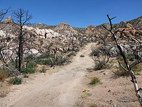
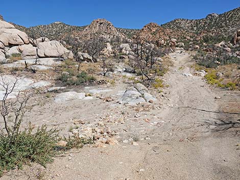
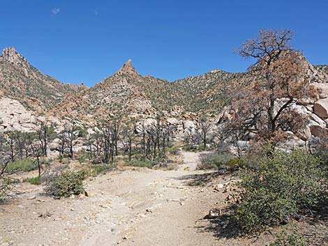
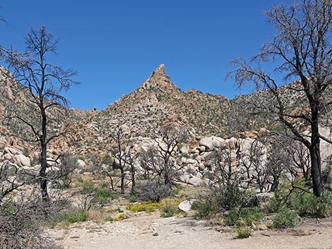
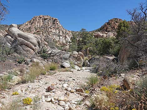
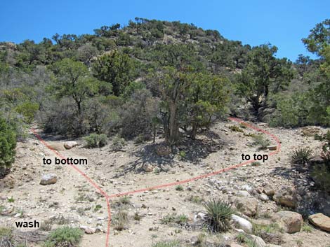
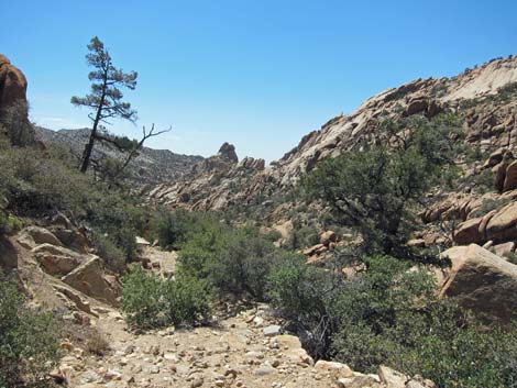
Before the fire, vegetation along the start of the trail was dense and diverse. Shrub Live Oak was thick, and the spaces between the oaks were filled with Manzanita, Ashy Silktassel, Cliffrose, Matchweed, Narrowleaf Goldenbush, Banana Yucca, and lots of cactus (Tulip Pricklypear, Grizzlybear Cactus, Mojave Kingcup Cactus, and Spinystar Cactus). Hikers could keep an ear out for Woodhouse's Scrub-Jays, and watch for Western Fence Lizards scurrying behind the rocks. The fire changed all of this. By about 0.2 miles out, now near the edge of the fire, the burn was more patchy, and stands of oaks and other trees remain in places. At about 0.36 miles out (Wpt. 02B), the Gaia GPS app shows that the trail turns right into a side wash (old road) and heads upstream. Hikers should stay left, which can be mistaken for the wash bottom at this point, and continue hiking up the main canyon. The side wash leads to interesting boulders that make for a nice lunch spot. Most drivers in 4WD vehicles will want to stop about 0.4 miles out, and by about 0.5 miles out, hikers are beyond the edge of the fire, and the vegetation remains as it has been for decades. |
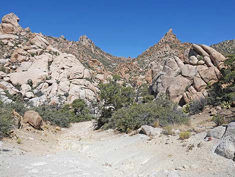
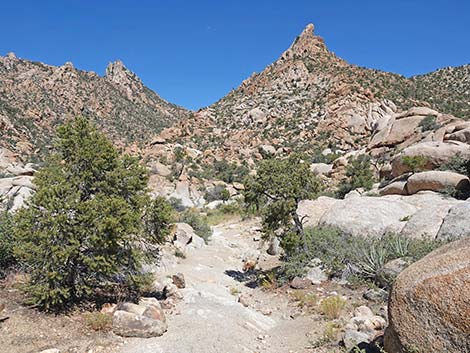
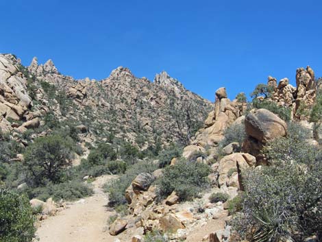
 Grand scenery (view E from Caruthers Canyon Rd) |
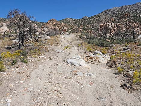
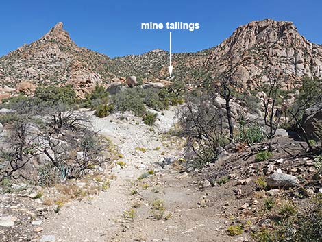
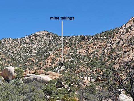
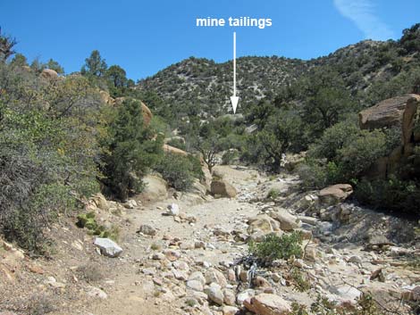
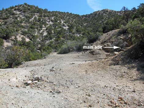
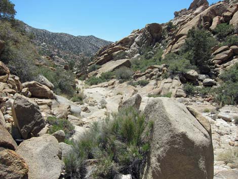
At about 0.65 miles out, the road crosses to the west side of the wash (Wpt. 03). Very few vehicles make it this far. The miners did some nice rock work along here laying in stones to hold up the road. The road eventually crosses back to the east side of the wash (Wpt. 04) and runs up along rocky cliffs where the road was cut into the hillside. A landslide here (Wpt. 05) blocks the road, keeping all vehicles from continuing up the canyon. The old road runs up the east side of the canyon, then once again crosses the wash (Wpt. 06) to the west side. Running along the west side of the wash, the road briefly dips into the wash, then cuts out again onto the west side. At about this point, tailings from the Giant Ledge Mine become visible farther up the canyon. The road crosses the wash (Wpt. 07) to the east side for the last time, and just across the wash, the road splits (Wpt. 08). To the left, the road runs about 100 feet to the base of the tailings pile (Wpt. 09) at the edge of the wash. A collapsed wood-and-tin ore chute lies crumpled on the bottom of the tailings pile. The chute probably carried tailings to the far edge of the pile where they could be dumped over the edge. |
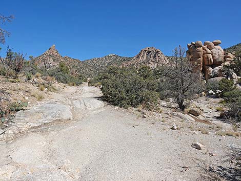
 Caruthers Canyon Rd continues (view N) |
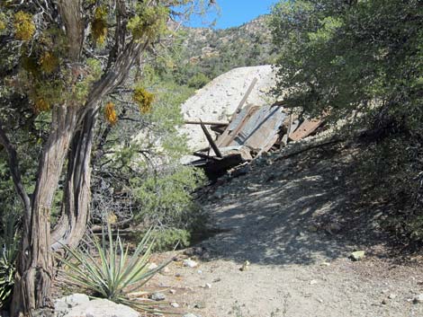
Either climbing steeply up the side of the tailings pile or walking up the right fork on the road, the route arrives on a flat area atop the tailings pile (Wpt. 10) and some of the mine openings. Note that walking up the road to the right, the first adit encountered has collapsed, despite timbers intended to hold it open. Let this stand as a warning to hikers - mines are never safe to enter. Atop the tailings pile, just around the corner to the east, an old pipe comes out of the main adit. To the right is a shaft - don't get too close to the edge! To the left are other adits. Straight up the hill is a shaft and an adit, and up across the hillside 100 yards to the east is another adit. I didn't record good notes here, but these three sites were the main areas of activity, although I've underestimated the number of adits. For hikers who want to see inside the mines without the danger, click here. Return to the trailhead by following your footprints back the old road to the trailhead (Wpt. 01). |
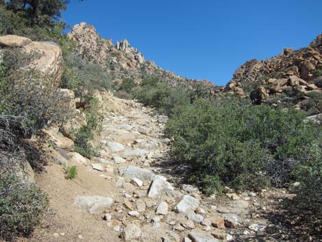
 Caruthers Canyon Rd at first of many rocky spots (view N) |
 Caruthers Canyon Rd continues (view N) |
 Grand scenery (view NE from Caruthers Canyon Rd) |
 Caruthers Canyon Rd starting into another rocky area (view N) |
 Caruthers Canyon Rd at another rocky area (view N) |
 Caruthers Canyon Rd at another rocky area (view N) |
 Caruthers Canyon Rd at another rocky area (view N) |
 Grand scenery (view NE from Caruthers Canyon Rd) |
 Caruthers Canyon Rd at a steep sideslope (view N) |
 Caruthers Canyon Rd improves a bit (view N) |
 Caruthers Canyon Rd improves a bit (view N) |
 Caruthers Canyon Rd entering another burned area (view N) |
 Caruthers Canyon Rd with some green trees (view NW) |
 Caruthers Canyon Rd at another rocky area (view N) |
 Caruthers Canyon Rd approaching a side wash (view N) |
 A different mine, not on this route (view NE zoom) |
 Caruthers Canyon Rd dropping into a side wash (view N) |
 Gaia App says to turn up this wash -- don't do it (view NE) |
 Don't follow Gaia App: road does not go up this wash (view NE) |
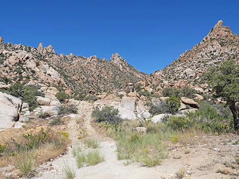
 Caruthers Canyon Rd continues up the main canyon (view N) |
 Grand scenery (view NW from Caruthers Canyon Rd) |
 Caruthers Canyon Rd with lots of small rocks (view N) |
 Caruthers Canyon Rd at a rough patch (view N) |
 Caruthers Canyon Rd at another campsite on the right (view N) |
 Campsite on the right (view SE from Caruthers Canyon Rd) |
 Caruthers Canyon Rd continues up the main canyon (view N) |
 Caruthers Canyon Rd (view N) |
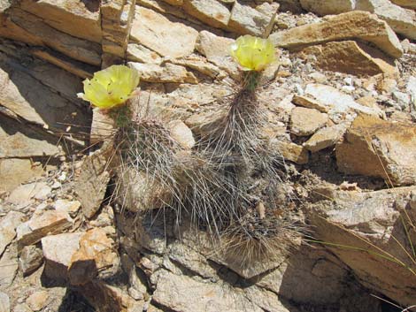 Grizzlybear Cactus in flower on the side of the trail |
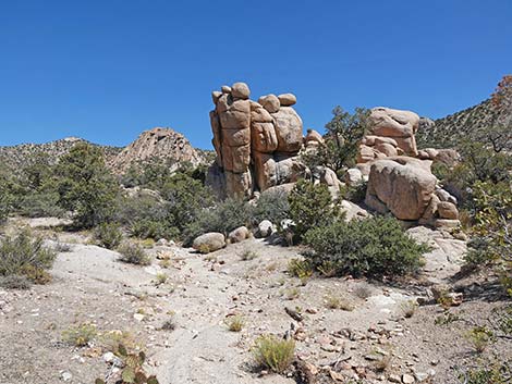
 Balanced rocks and stone spires |
 Balanced rocks and stone spires |
 Balanced rocks and Shrub Live Oak |
 Narrow road (view N) |
 Last campsite (view NE) |
 Crags and spires |
 Crossing wash to west side (view N) |
 Stonework holds up roadway |
 Crossing wash to east side (view N) |
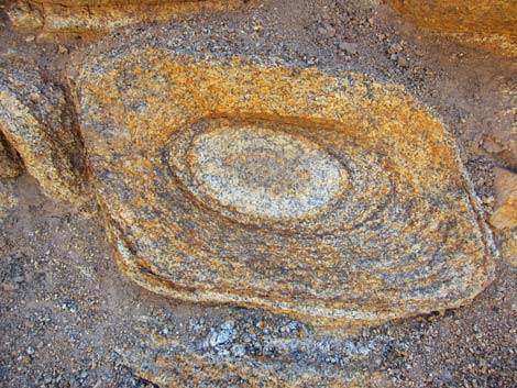 Unusual erosion pattern in granite boulder |
 Landslide blocks road (view N) |
 Old road continues past the landslide (view N) |
 Old road continues past the landslide (view N) |
 Last wash crossing; mine tailings visible (view NE) |
 Old road forks just before mine area |
 To the left: collapsed ore chute and tailings pile |
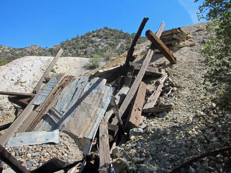 To the left: collapsed ore chute and tailings pile |
 Collapsed ore chute and tailings pile (view from above) |
 Tailings pile |
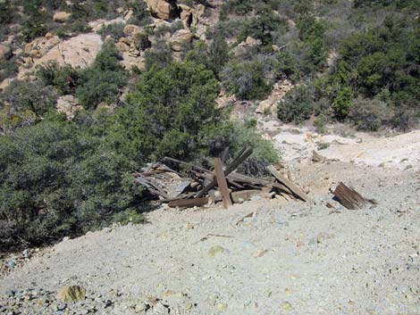
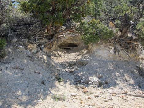 To the right: collapsed adit with roofing timbers |
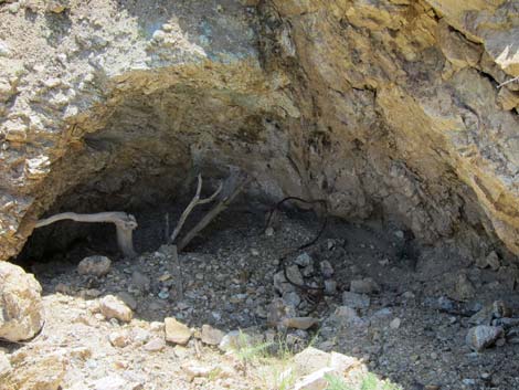 To the right: another collapsed adit? |
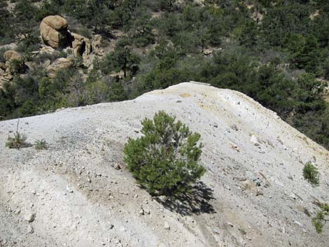
 Atop tailings pile (view E) |
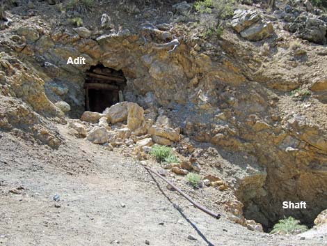 Main adit and shaft |
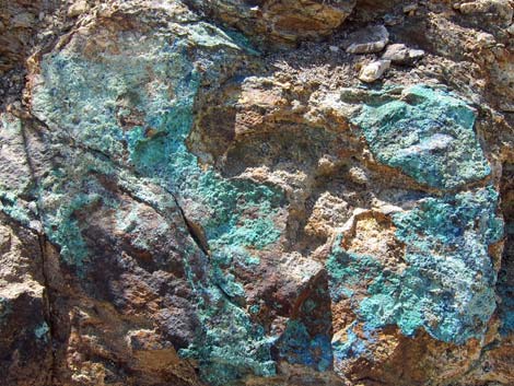 Copper ore in the rock wall outside the main adit |
 New York Mountains (view NW from main adit) |
 New York Mountains (view NW from east adit) |
Hiking Back Down the Caruthers Canyon
 |
 |
 |
 |
 |
 |
 |
 |
Table 1. Trail Coordinates Based on GPS Data (NAD27; UTM Zone 11S). Download Hiking GPS Waypoints (*.gpx) file.
| Wpt. | Location | UTM Easting | UTM Northing | Elevation (ft) | Point-to-Point Distance (mi) | Cumulative Distance (mi) |
|---|---|---|---|---|---|---|
| 01 | Trailhead | 654841 | 3901041 | 5,674 | 0.00 | 0.00 |
| 02A | Caruthers Cyn Trail Sign | 654883 | 3901089 | 5,669 | 0.05 | 0.05 |
| 02B | Fork in the Canyon | 654967 | 3901489 | 5,703 | 0.31 | 0.36 |
| 03 | Road Crosses Wash West | 654720 | 3901834 | 5,744 | 0.29 | 0.65 |
| 04 | Road Crosses Wash East | 654622 | 3902002 | 5,817 | 0.14 | 0.79 |
| 05 | Landslide | 654632 | 3902087 | 5,961 | 0.07 | 0.86 |
| 06 | Road Crosses Wash West | 654654 | 3902306 | 5,961 | 0.16 | 1.02 |
| 07 | Road Crosses Wash East | 654693 | 3902384 | 5,975 | 0.07 | 1.09 |
| 08 | Road Forks | 654700 | 3902384 | 6,036 | 0.01 | 1.10 |
| 09 | Base of Tailings Pile | 654710 | 3902424 | 6,001 | [0.03] | . |
| 10 | Giant Ledge Mine, Main | 654737 | 3902438 | 6,070 | 0.07 | 1.17 |
| 11 | Giant Ledge Mine, Upper | 654763 | 3902449 | 6,100 | 0.02 | 1.19 |
| 12 | Giant Ledge Mine, East | 654831 | 3902460 | 6,161 | 0.05 | 1.24 |
| 01 | Trailhead | 654841 | 3901041 | 5,674 | 1.24 | 2.48 |
Happy Hiking! All distances, elevations, and other facts are approximate.
![]() ; Last updated 241009
; Last updated 241009
| Hiking Around Mojave Preserve | Hiking Around Las Vegas | Glossary | Copyright, Conditions, Disclaimer | Home |